
Diploma in Geomatics – Level 1
This program introduces the fundamentals of geomatics, covering land surveying, mapping, and the application of geospatial technologies. It aims to develop an initial understanding of geomatics principles and practices as preparation for further studies and applications in related fields.
Apply for Programme Registration
Why Choose This Programme?
This section explains the learning approach and the strengths of the programme structure as a reference for students before selecting an academic pathway in the field of geomatics.

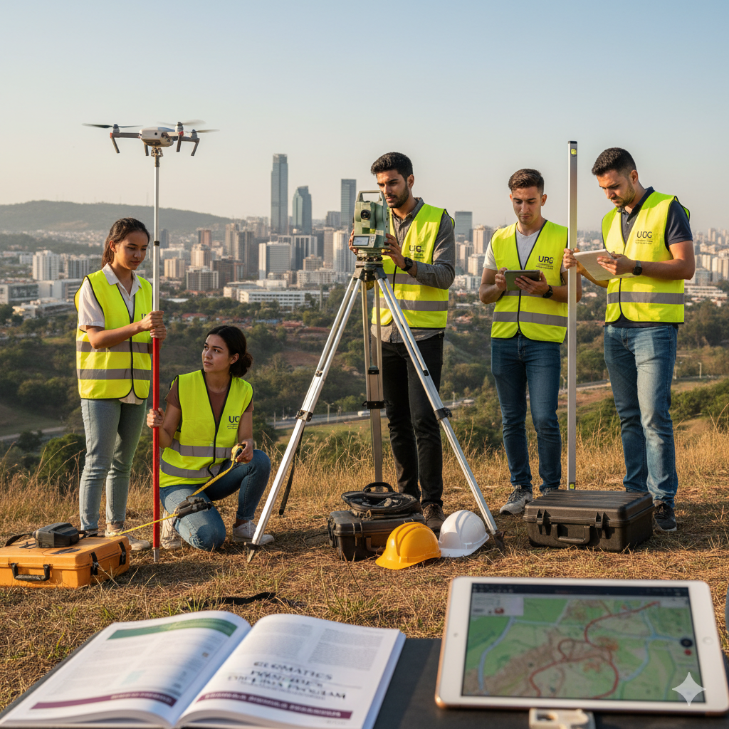
Surveying & Mapping Fundamentals
Exposure to the fundamentals of land surveying and mapping, including data collection methods and map interpretation.

Practical Training
Learning activities include practical training in laboratories and fieldwork to support theoretical understanding.

Experienced Academic Staff
Modules are delivered by academic staff with relevant academic backgrounds and experience in the field of geomatics.

Skills & Education Pathways
The knowledge and skills acquired can support further studies or skills development in related fields.
Core Modules of the Diploma in Geomatics
This section outlines the core modules that form the structure of the programme, providing an initial overview of the scope of knowledge and skills that will be acquired.
Fundamentals of Geomatics & Surveying
Introduction to geomatics concepts, basic land surveying, coordinate systems, and the use of surveying equipment.

Mapping & Cartography
Exposure to mapping techniques, geospatial data management, and the fundamentals of GIS and cartography.

GIS Technology & Software
Introduction to GIS software, basic geospatial data analysis, and digital mapping information management.
Field Practical Training
Field training involving the use of surveying equipment, GPS, and real-world measurement techniques.

Data Analysis & Management
Fundamentals of survey data analysis, report preparation, and interpretation of geospatial data.
Professional & Academic Exposure
Introduction to the geomatics work environment and pathways for progression to the next level of study.

Career & Education Pathways
This section outlines the employment pathways and education progression options that may be considered after completing studies in the field of geomatics.

Surveying & Land Measurement
Fundamental knowledge in geomatics supports involvement in land surveying, mapping, and field data collection activities.
GIS & Geospatial Data
Exposure to GIS and geospatial data management is applied in digital mapping and spatial analysis.
Fieldwork & Mapping
Field training enhances understanding of measurement processes and on-site mapping activities.
Education Progression
Graduates may consider progressing to higher levels of study, subject to institutional requirements.
Entry Requirements & Eligibility
This section outlines the basic entry requirements and supporting documents required for admission into the Diploma in Geomatics programme.
SPM / STPM Leavers
Minimum pass in SPM or an equivalent qualification, subject to specific subject requirements set by the institution. This programme is suitable as an introduction to the field of geomatics and land surveying.
Professionals / Working Individuals
Open to working individuals who wish to enhance their knowledge in GIS, mapping, and geospatial technologies through a structured learning pathway.

Supporting Documents
Copies of the Identity Card, relevant academic transcripts, and documents related to technical experience or training (if applicable).
Programme Schedule & Duration
This section explains the study duration, class schedule structure, and learning methods to help students understand the time commitment required throughout the Diploma in Geomatics programme.

Standard Duration
The study period typically ranges between 2 to 3 years, depending on the programme structure and the mode of study undertaken.

Class Schedule
Learning includes theoretical sessions conducted online, as well as practical fieldwork and GIS laboratory training based on module requirements.
Learning Format
The programme combines theory, field practical work, GIS software training, and academic assignments as part of the learning process.

Fees & Financial Assistance
The Diploma in Geomatics programme offers a reasonable fee structure along with financial assistance options to support students in planning their studies more effectively and focusing on academic learning as well as practical training.

Installment Facility
Students may pay their fees through installment plans to facilitate financial planning without affecting their study commitments and practical training.
PTPTN Assistance
Eligible students may apply for funding through PTPTN to cover tuition fees and other costs related to diploma-level learning.

Sponsorship & Special Support
Selected students may have opportunities to receive sponsorship or special support through industry and institutional collaborations to assist their academic journey.
Frequently Asked Questions (FAQ)
This section compiles common questions related to the Diploma in Geomatics programme to help prospective students understand the study structure, learning methods, and career pathways after graduation.
Who is suitable to join this programme?
This programme is suitable for SPM leavers, individuals who wish to build skills in Geomatics & Surveying, or those interested in starting a career in the GIS, Surveying, and Geospatial industry.
Is the programme conducted online or physically?
The programme is delivered online through KDM Global EDU Online, supported by field practical sessions and GIS projects supervised by experienced academic staff from Universiti Geomatika Malaysia.
How long is the duration of the programme?
The duration of study typically ranges from 2 to 3 years, depending on the programme structure and learning mode undertaken.
What are the career prospects after graduation?
Graduates may pursue careers as GIS Technicians, Survey Assistants, Land Surveyors, or GIS Analysts, as well as continue their studies at the Bachelor’s Degree level in Geomatics with appropriate credit transfer.
Ready to Start a Career in the Geomatics Industry?
Enrol in the Diploma in Geomatics programme and gain academic guidance as well as hands-on experience through field practical training and GIS projects with KDM Global EDU Online and Universiti Geomatika Malaysia.