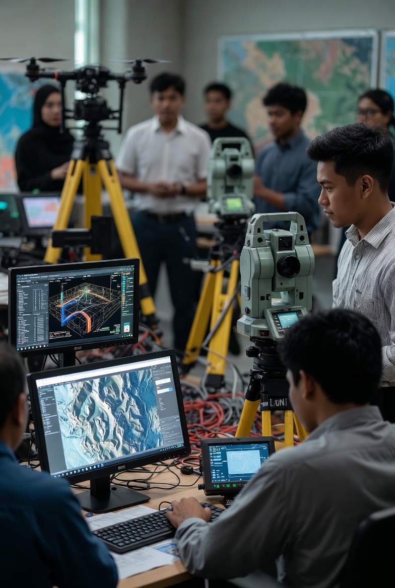

PhD in Geomatics
The KDM Global EDU Online programme enables researchers and professionals
to gain advanced mastery in geospatial technology, 3D modelling, GIS, and geographic data analysis.
This programme is suitable for candidates who aim to lead large-scale
geospatial research or pursue academic development
at the doctoral level.

Why Choose This Programme?
The PhD in Geomatics programme provides an advanced research pathway
for candidates who seek to deepen their expertise in
geospatial technology, GIS, 3D modelling, and geographic data analysis.
This programme is developed through academic and industry support
in collaboration with KDM Global EDU Online, with an emphasis
on the development of research expertise and impactful spatial analysis capabilities.
Geospatial Technology & GIS
Advanced mastery of GIS, digital mapping, and spatial analysis for academic research and data-driven industry applications.

Spatial Analysis & 3D Modelling
A strong focus on 3D modelling, geographic data integration, and advanced spatial analysis for evidence-based solutions.

Research Leadership
Development of capabilities to lead research initiatives, produce academic journal publications, and engage in institutional collaboration.

Professional Supervision & Mentorship
Supervision by senior researchers and geospatial experts to ensure research quality, rigour, and consistency.
Core Modules PhD in Geomatics
This PhD structure focuses on advanced research and the development of deep expertise in the field of Geomatics, enabling candidates to master geospatial technology, GIS, 3D modelling, spatial data analysis, as well as research leadership for academic and professional pathways.
Geospatial Technology & GIS
Advanced mastery of GIS systems, digital mapping, and spatial analysis for academic research and data-driven industry applications.
Spatial Data Analysis & 3D Modelling
3D modelling, large-scale geographic data processing, spatial simulation, and evidence-based decision support.

Geomatics Research Methodology
Advanced research methods, study design, geospatial data analysis, and PhD thesis writing.
Research Leadership & Management
Academic leadership, research project management, university–industry collaboration, and scholarly publication.

Career Prospects & Opportunities
Graduates of the PhD in Geomatics have opportunities to build careers in advanced geospatial research, GIS system development, 3D modelling, spatial data analysis, as well as academic and high-technology industry leadership.
Geospatial Researcher
Lead researcher roles at universities, research institutes, or geospatial technology organisations at national and international levels.

Spatial Data & GIS Analysis Specialist
Large-scale geographic data analysis, 3D modelling, and GIS system development for research and industry sectors.
Academic & University Lecturer
Academic careers as lecturers, research supervisors, and scholarly journal authors in the fields of Geomatics and GIS.
GIS & Geospatial Systems Developer
Development of GIS systems, spatial data integration, and geospatial solutions for public sector and industry applications.

Research Leadership & Management
Leadership of large-scale geospatial research projects, university–industry collaboration, and strategic planning.
Entry Requirements & Eligibility
Admission to the PhD in Geomatics programme is selective and based on research readiness. Assessment is conducted by considering academic background, research experience, and the suitability of the proposed study with the available areas of expertise and supervision.
Master’s Degree Holders / Equivalent
Minimum possession of a Master’s Degree in Geomatics, Geospatial, GIS, Earth Sciences, or a related field. Suitable for candidates seeking advanced research, spatial analysis, and geospatial technology expertise.
Research / Professional Experience
Candidates with research experience, geospatial fieldwork, GIS projects, or scholarly publications are encouraged. Such experience supports the smooth progression of research and PhD thesis writing.

Supporting Documents
Copies of Identity Card / Passport, Master’s transcripts, a proposed research topic (research proposal), academic CV, and a supervisor’s support letter (if available) to support the PhD application.
Programme Schedule & Duration
The PhD in Geomatics programme is conducted on a fully research-based mode, without a structured class timetable as in taught postgraduate programmes. The duration and implementation of study depend on the scope of research, research progress, and scholarly publication requirements throughout the period of candidature.

Standard Duration
The duration of study typically ranges between 3 to 5 years, depending on the scope of research, thesis progress, and publication requirements. Suitable for both full-time and part-time candidates.

Research Schedule
Research-based study includes Geomatics fieldwork, GIS analysis, spatial model development, and journal publications. Supervision sessions are conducted online or face-to-face depending on research requirements.
Research Format
Emphasis on in-depth research, geospatial data analysis, GIS development, PhD thesis writing, and final assessment through viva voce.

Fees & Financial Assistance
The fee structure for the PhD in Geomatics programme is designed to support long-term, research-based study. Various forms of financial assistance and research support are available to enable candidates to focus fully on thesis development and scholarly publication.

Instalment Facility
PhD tuition fees may be paid by instalments to facilitate financial planning, without compromising research focus, fieldwork activities, and thesis development.

Sponsorship & Research Grants
Students may apply for research grants, university sponsorships, or special funding to cover the costs of fieldwork, GIS software, satellite data, and geospatial equipment.

Industry Support & Collaboration
Opportunities for collaboration with GIS companies, geospatial agencies, and research institutions to support large-scale PhD research and facilitate industry knowledge transfer.
Frequently Asked Questions (FAQ)
This section outlines frequently asked questions related to the structure, duration, and implementation of the PhD in Geomatics programme. It aims to assist prospective candidates in understanding the nature of research-based study before submitting a formal application.
Who is suitable to join this programme?
This programme is suitable for Master’s graduates or professionals with a background in Geomatics, GIS, geospatial studies, mapping, or spatial data analysis who wish to enhance their expertise to an advanced research level.
What is the mode of study for this PhD programme?
This programme is conducted fully as a PhD by Research, involving supervisory guidance, academic consultation, Geomatics/GIS fieldwork, geospatial data analysis, as well as academic and industry support.
How long is the duration of study?
The duration of study typically ranges between 3 to 5 years, depending on the scope of research, thesis progress, and scholarly publication requirements.
What are the pathways after graduation?
Graduates of the PhD in Geomatics may pursue careers as geospatial researchers, GIS specialists, university lecturers, or be involved in collaborative industry and government projects.
The Next Step in Geomatics Research
Applications to the PhD in Geomatics programme are open to candidates who are interested in developing advanced research in the fields of geospatial studies, GIS, and spatial technologies through structured academic supervision.